Guide · The Han River
The Han River, mostly for runners.
Half this page is for runners, the path, the bridges, the water fountains. The other half is for the rest of the trip: bike rentals, the river bus, where to picnic, which park to actually go to. The river is the centre of running life in Seoul, but it is the centre of a lot of other things too.
For runners
The path, the bridges, the practical bits.
How the path is laid out
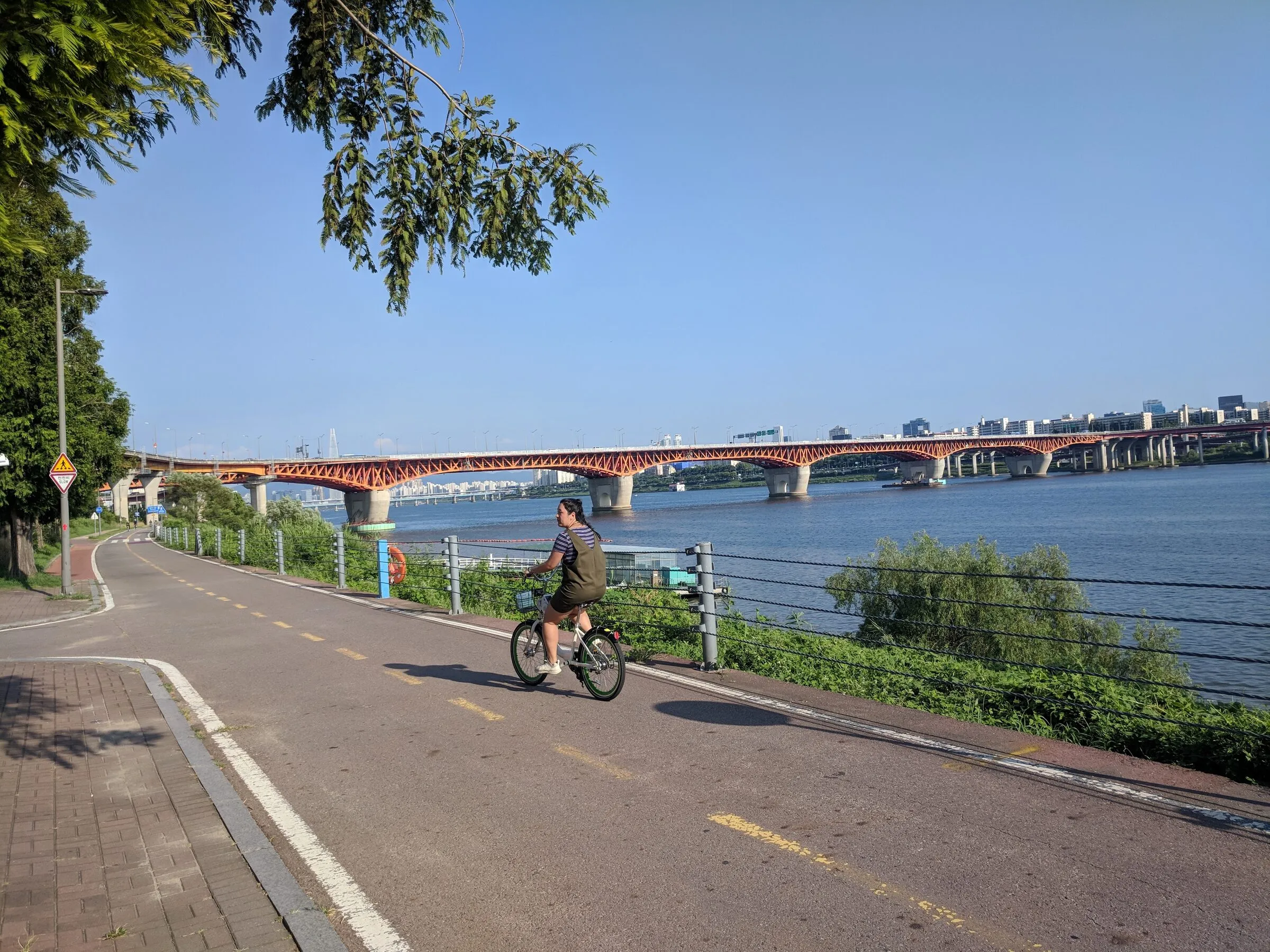
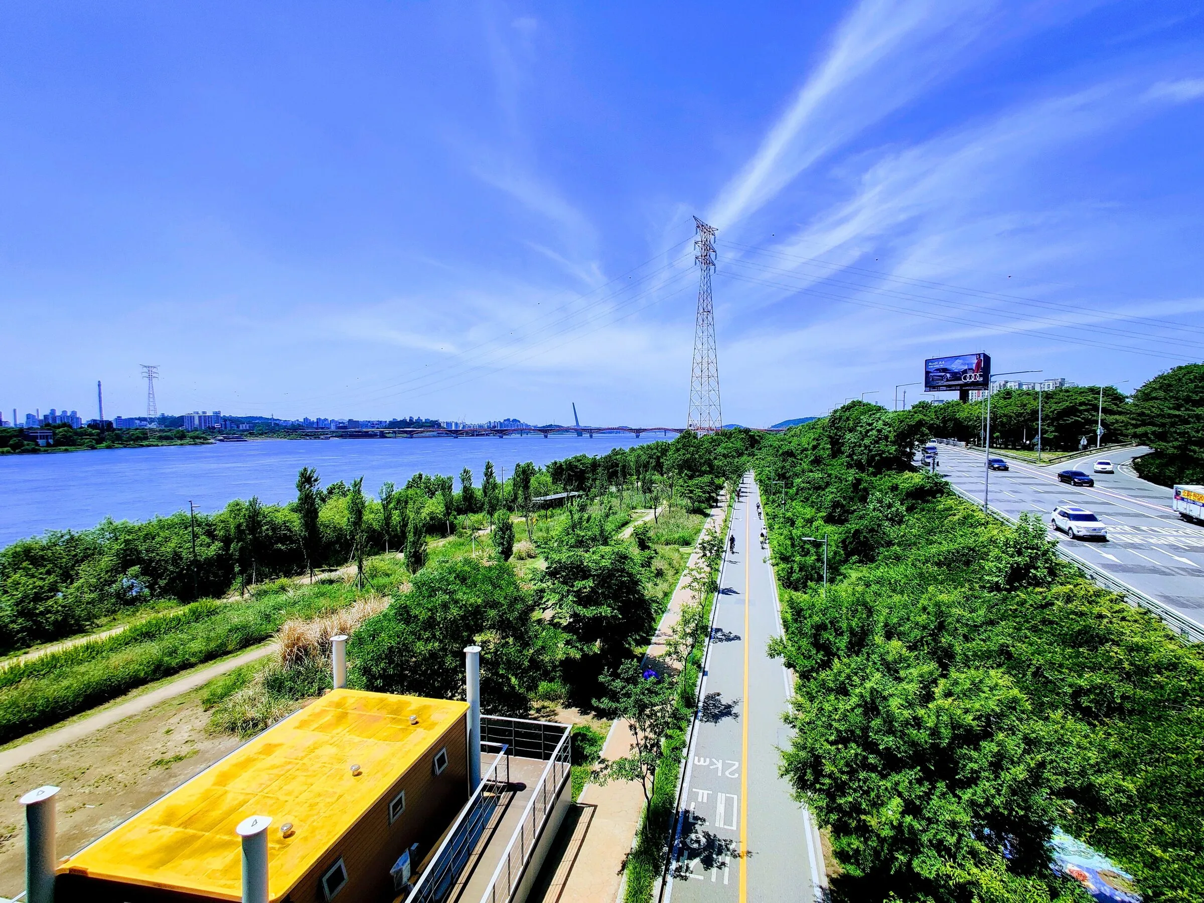
The Han River path runs the full length of the city on both banks, roughly 41 km end to end. Through most of central Seoul the path is split: a wide bike lane on the river side, a narrower running and walking lane on the inside. Where they are not split, runners stay on the river side and walk single file. The signposted distances in kilometres are on the south-bank cycle route.
Running stretches you actually use are usually between two bridges and back. A short list, west to east:
- Mangwon ⇄ Yanghwa, about 3 km out, popular morning loop in Mapo.
- Mapo ⇄ Wonhyo, about 4 km out, with skyline views on the return.
- Yeouido loop, about 8 km around the island via Mapo and Wonhyo bridges.
- Banpo ⇄ Hannam, about 4 km out, the moonlight-fountain stretch on the south bank.
- Seongsu ⇄ Jamsil, about 5 km out, with Seoul Forest at the start.
Water, toilets, convenience stores
Water fountains run roughly every kilometre, drinkable and turned off in winter. Public toilets are at every park (Mangwon, Mapo, Yeouido, Banpo, Ichon, Ttukseom, Jamsil and smaller ones in between). At least one 24-hour convenience store sits at every park entrance, GS25, CU and 7-Eleven all have river-park branches and most of them have ice tea, sports drinks and bananas.
One-way runs via the river bus
The Hangang Bus (한강버스) is the city ferry that links several riverside docks. Most of its passengers are sightseers, but it is a quiet runner's trick for one-way runs: take the boat out and run back along the bank. It is comfortable, scenic, and the schedule is more reliable than the bike-share for an out-and-back plan. The future "ferry out, run back" route on this site uses it.
Bike rental and the rest of the river
What the river is good for when you are not running.
Public bikes (Ttareungi)
The city's bike-share system, Ttareungi (따릉이), has docking stations at every Hangang park along the route. You unlock a bike with the Ttareungi app, sign-in requires Korean phone payment, so travellers without one usually borrow a friend's account or rent privately. A one-day pass is around 1,000 KRW; one-hour windows are the default unlock and you can move bikes between stations.
Private rentals
Bigger parks (Yeouido, Banpo, Jamsil) have private rental shops that take walk-ins. They rent single bikes, tandems and quads, the quad pedal-carts are a Han River fixture for families and groups. Expect roughly 3,000–6,000 KRW per hour for one rider, more for tandems and quads. Bring ID; cash is fine.
Picnic, ramen, fried chicken
The Han River park picnic is its own genre. The way it works is simple: walk into a convenience store at the park entrance, order instant ramen at the noodle machine, find a spot on the grass, eat. Most park convenience stores have a ramen counter at the back; busier parks (Banpo, Yeouido) have dedicated outdoor ramen kiosks. For something larger, every big chicken chain delivers to the river, pick a landmark (a bench, a tree) and they will find you. This is a Seoul summer-evening thing more than a runner thing, but it is too characteristic to leave out.
Outdoor pools and watersports
Yeouido, Ttukseom and Jamsil have outdoor swimming pools that open through July and August. Jamsil and Ttukseom rent kayaks and paddle boats. The river itself is not for swimming.
The Banpo Bridge fountain
The Banpo Bridge Moonlight Rainbow Fountain runs from spring through autumn, sets daily from about noon to nine in the evening, and is worth catching once after dark. The best viewing spot is the south bank under Banpo Bridge itself; the north bank at Ichon is the runner's view.
FAQ
Short answers.
-
Where can I rent a bike at the Han River?
Two ways. The city's Ttareungi public bike system has docking stations at every Hangang park (Mangwon, Mapo, Yeouido, Banpo, Ichon, Ttukseom, Jamsil and more). You unlock a bike with the Ttareungi app and Korean phone payment; daily passes are around 1,000 KRW. Private rental shops sit inside the bigger riverside parks (notably Yeouido, Banpo and Jamsil) and rent cruisers, tandems and quads by the hour; expect 3,000–6,000 KRW for one rider per hour. Bring ID.
-
Is the Han River good for walking, running and cycling?
Yes, the riverside path runs the whole length of central Seoul on both banks and is paved, lit, mostly flat, and separated into pedestrian and bicycle lanes through most of its length. Distances along the south bank cycle route are signposted in kilometres. The riverside parks themselves widen out at Yeouido, Banpo, Ttukseom and Jamsil, and the path between them is continuous.
-
What is the Han River bus and how does it work?
The Hangang Bus (한강버스) is the city ferry that runs along the river between several riverside docks, including Mangwon, Yeouido and Ttukseom. It is mainly a sightseeing line, but it is genuinely useful for runners who want to do a one-way run: take the boat one direction and run the bank back. Schedules and fares are on the official Hangang Bus site.
-
Which Han River park is the best for runners?
There is no single best, they have different characters. Mangwon and Mapo (north bank) are quieter and the most-used by everyday runners. Yeouido (the island) has the Banpo Bridge fountain view at night. Banpo (south bank) has the moonlight fountain itself. Ichon (south bank) gives the prettiest sunsets. Jamsil (east end) has Lotte Tower over your shoulder and the cleanest connection to Olympic Park. Most local runners pick by what is nearest, not by which is best.
-
How long is the Han River running path?
Roughly 41 km end to end, counted along the bike route from Gimpo in the west to Hanam in the east. In practice you run a stretch between two bridges, a typical Han River run is 5–12 km out and back between two of Mapo, Yanghwa, Seongsu, Banpo, Hannam or Wonhyo bridges.
-
Can you swim in the Han River?
No, public swimming in the river is not allowed, and the river is not clean enough to make it a good idea regardless. The riverside parks at Yeouido, Ttukseom and Jamsil have summer outdoor swimming pools that open July–August, and a few of the parks have wading fountains for kids.
Run the river with me
A guided run is the fastest way to learn the river.
On a guided run I take you through the stretches and the bridges in one morning, so you have a working map of the river for the rest of your trip. Bikes, picnics and the rest are then yours to explore.
Keep exploring: today's running weather, the Han River running routes, and the Korea race calendar.